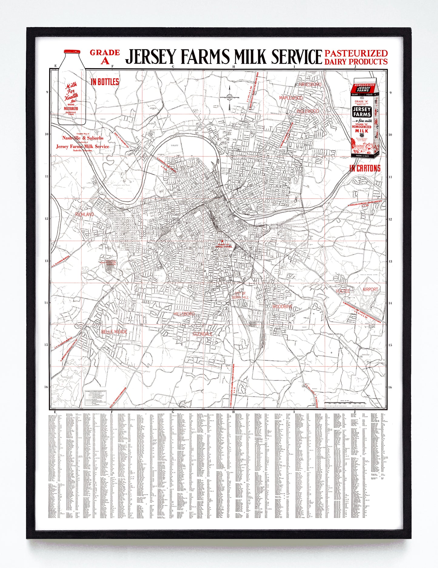
“Complete Map of Nashville & Suburbs” print by the Jersey Farms Milk Service (1950)
“Complete Map of Nashville & Suburbs” print by the Jersey Farms Milk Service (1950)
Couldn't load pickup availability
Whether or not you're into Jersey Farms Milk Service (est. 1931) memorabilia, this two-colour map of Nashville as it stood in 1950 is a crisp look into mid-century middle of Tennessee. The illustrations of Jersey milk in bottle and carton form are handsome, the street listings at bottom are exhaustive, and a star at map's centre shows us exactly where the "plant of Jersey Farms" stood.
Where exactly was that? At the northwest corner of 8th Ave. and South St., a location just west of Fort Negley that barely dodged the installation of the I-40 and I-65. While I'm not sure when the Jersey plant was demolished, the site currently hosts the enormous Graybar electrical supply store.
A reproduction available at 12x16" or 18x24" on Epson Enhanced Matte 192 gsm paper printed with Epson UltraChrome XD2 archival ink. Sold in an open edition, unframed. Restored from this object from the Tennessee Virtual Archive.