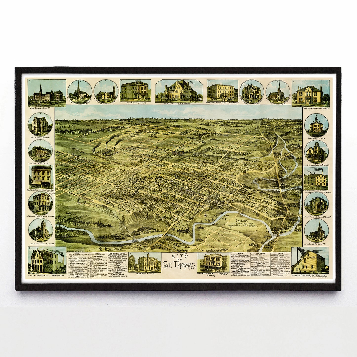
“City of St. Thomas” print by William Nathaniel Wesbroom (1886)
“City of St. Thomas” print by William Nathaniel Wesbroom (1886)
Couldn't load pickup availability
William Nathaniel Wesbroom drew three incredible maps in 1885 and 1886. One of Woodstock, one was of Ingersoll, and one was of St. Thomas, placing all three of his subjects in a convenient 65 km radius of each other and relatively close to his Toronto home and headquarters.
How else did he work efficiently? All three of the maps closely share a similar aesthetic, right down to the almost Xerox-level reuse of the shaped vignette frame around each of the images. Open up the other two images (that you can find elsewhere in the Paper Cities collection) and you'll see exactly what I mean.
A reproduction available at 18x12" or 36x24" on Epson Enhanced Matte 192 gsm paper printed with Epson UltraChrome XD2 archival ink. Sold in an open edition, unframed. Based on this original public domain image held the Elgin County Archives.