“City of Toronto” print by the Toronto City Morgue (1946)
“City of Toronto” print by the Toronto City Morgue (1946)
Couldn't load pickup availability
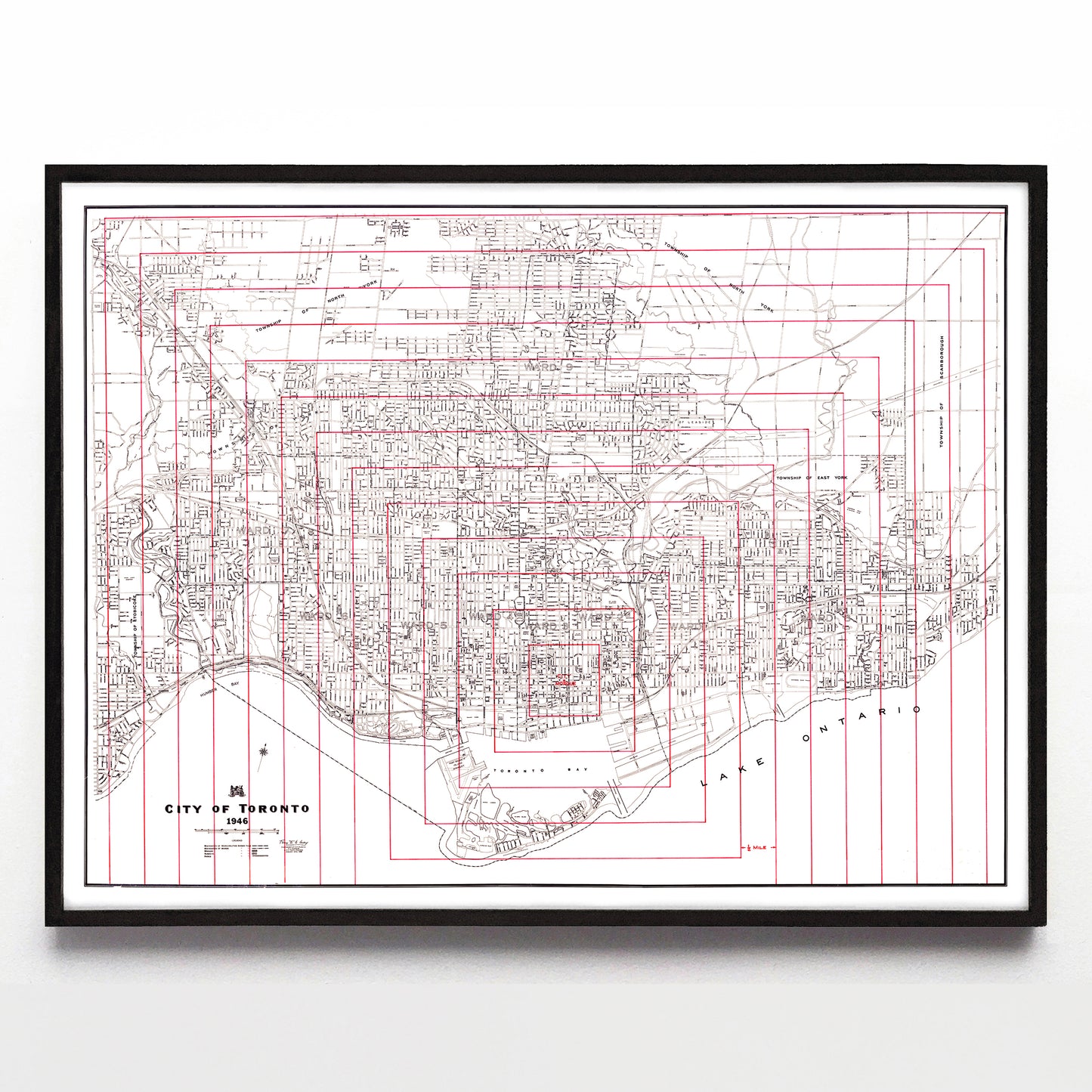
Sometimes very "normal" city maps are turned into very unique ones by their owners, and this particular 1946 City of Toronto map was probably possessed by whoever dispatched hearses from what was then the city's only morgue. Its owner has drawn 13 concentric red rectangles around the labelled morgue (found in the middle of the block just northwest of Lombard and Jarvis), and each of those concentric rectangles are exactly a half mile distant from the other.
In that way, the hearse dispatcher could approximate how far (and thus how long it'd take) for a hearse to arrive. If there was a dead body at St. Clair and Bathurst, one could very quickly use this map to determine the hearse has to drive roughly 8 miles to get to it. How convenient is that?
A reproduction available at 16x12" or 24x18" on Epson Enhanced Matte 192 gsm paper printed with Epson UltraChrome XD2 archival ink. Sold in an open edition, unframed. Based on this original public domain image that I've found at the City of Toronto Archives.