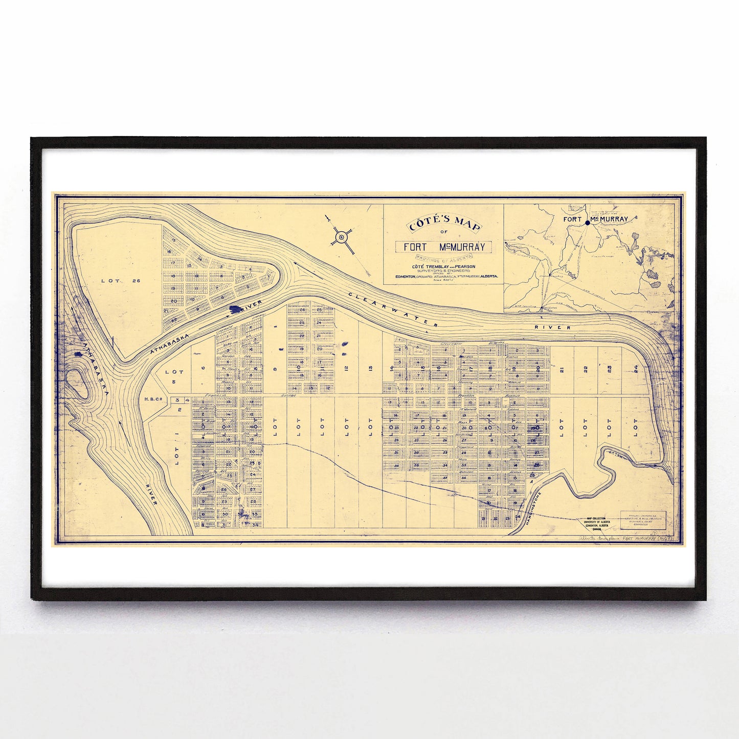
“Côté's Map of Fort McMurray Province of Alberta” print by Côté, Tremblay & Pearson (1912)
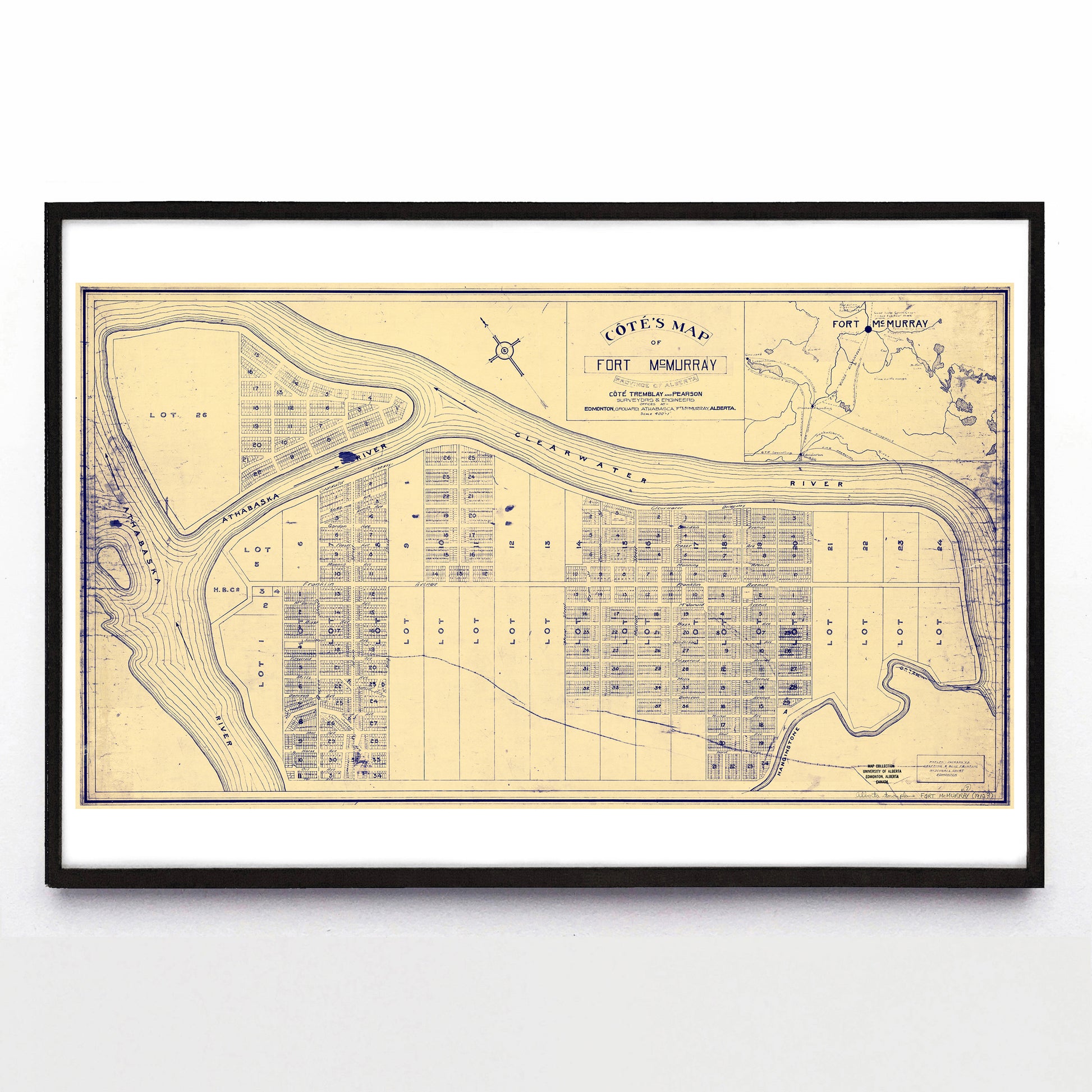
“Côté's Map of Fort McMurray Province of Alberta” print by Côté, Tremblay & Pearson (1912)
Couldn't load pickup availability
Côté & Co.'s map of Fort McMurray shows the majority of modern Fort Mac, but it also detours into speculative fiction: MacDonald Island Park has never been half-settled with houses. The inset map at top right includes a dozen proposed, under construction and "guaranteed" CN rail lines reaching north from Edmonton, as well as notes of where one can find "fine cattle range," "good land," and "tar sands."
The rough and interrupted line at bottom of the main map roughly traces the path of Highway 63, which itself was built on the existing right-of-way for the 1925-completed Alberta & Great Waterways Railway line. Speaking of speculative fiction, I'd be happy if a proper Fort McMurray historian schooled me on the details. My e-mail inbox is always open.
A reproduction available at 18x12" or 36x24" on Epson Enhanced Matte 192 gsm paper printed with Epson UltraChrome XD2 archival ink. Sold in an open edition, unframed.