"Guidal Landowners' Map of the Township of Guelph" print by Alfred E. Guidal (1917)
"Guidal Landowners' Map of the Township of Guelph" print by Alfred E. Guidal (1917)
Couldn't load pickup availability
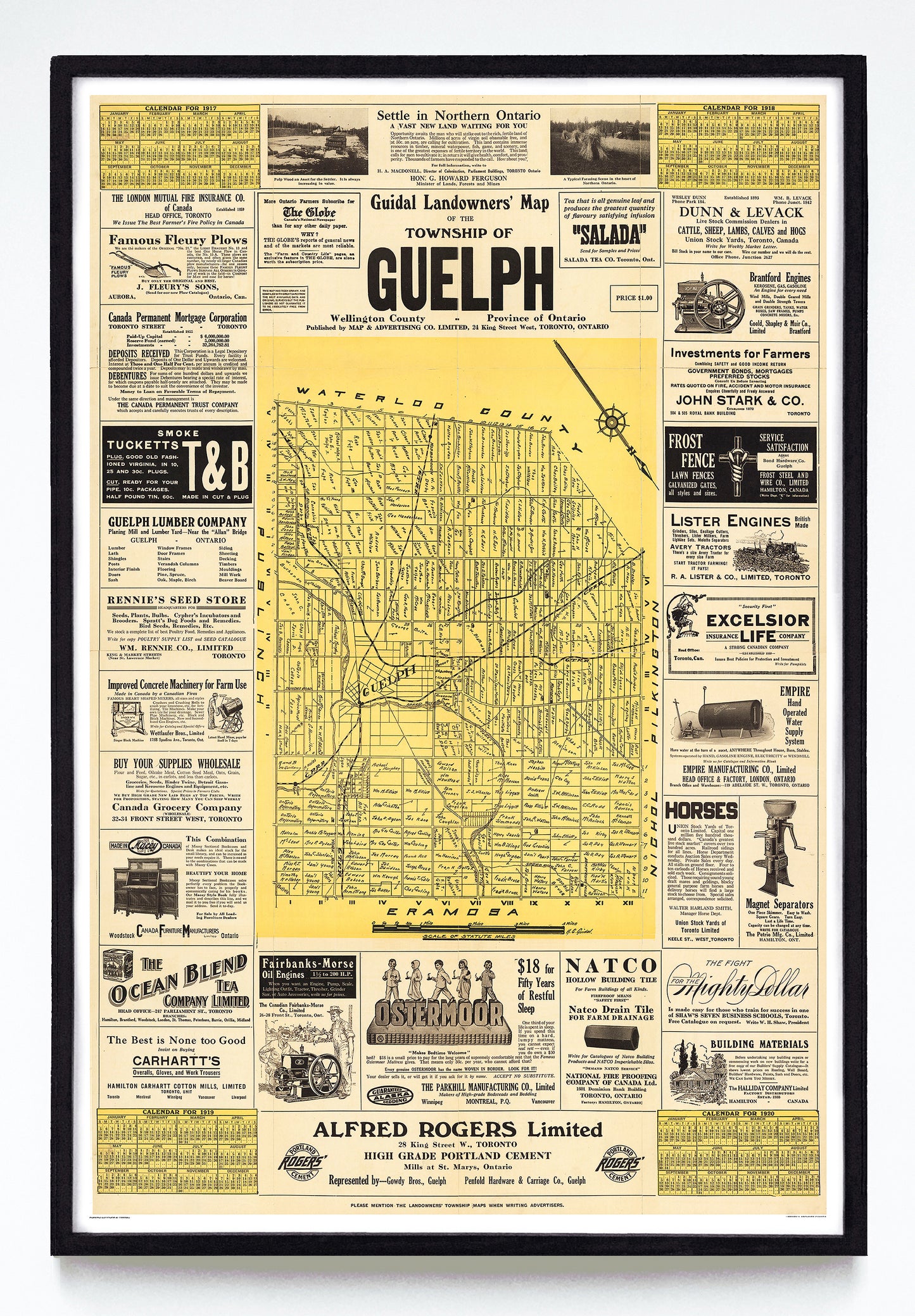
In the mid-1910s Ontarian entrepreneur Alfred E. Guidal made a few publishing gambles. The first was straightforward: a series of booklets under the Guidal Commercial Directory banner, intending to connect rural Ontarians with local businesses. The other was called the "Guidal Landowner Map," and it was the unique marriage of a map, a catalogue and four-year calendar into a single two-colour sheet.
The Township of Erin map has nice green colour fields, Trafalgar features pink, and the Township of Kenyon Glengarry County map advertises a suspicious “health giving violet ray.“ Around forty different editions were published that year, and the Ontario historian Bruce Elliott has done a marvellous job making a list of all known editions. The 1917 Guelph Guidal map, though, makes excellent use of my favourite colour and to me seemed worth restoring. You can get a look at the original at Library & Archives Canada right here.
Printed at the bottom of each sheet is the suggestion that the reader “mention the Landowners’ Township Maps when writing advertisers.” I suspect a few did, but not enough, as there is no record of Guidal maps after 1924 and he's mentioned as a "lumber estimator" in a 1921 copy of Canadian Forest Industries.
A reproduction available at 12x18" or 24x36" on Epson Enhanced Matte 192 gsm paper printed with Epson UltraChrome XD2 archival ink. Sold in an open edition, unframed. Based on this original public domain image held by Library & Archives Canada.