“Hathaway's Guide & Birds-Eye Map of Winnipeg” print by R. W. Hathaway & J. K. Wright (1911)
“Hathaway's Guide & Birds-Eye Map of Winnipeg” print by R. W. Hathaway & J. K. Wright (1911)
Couldn't load pickup availability
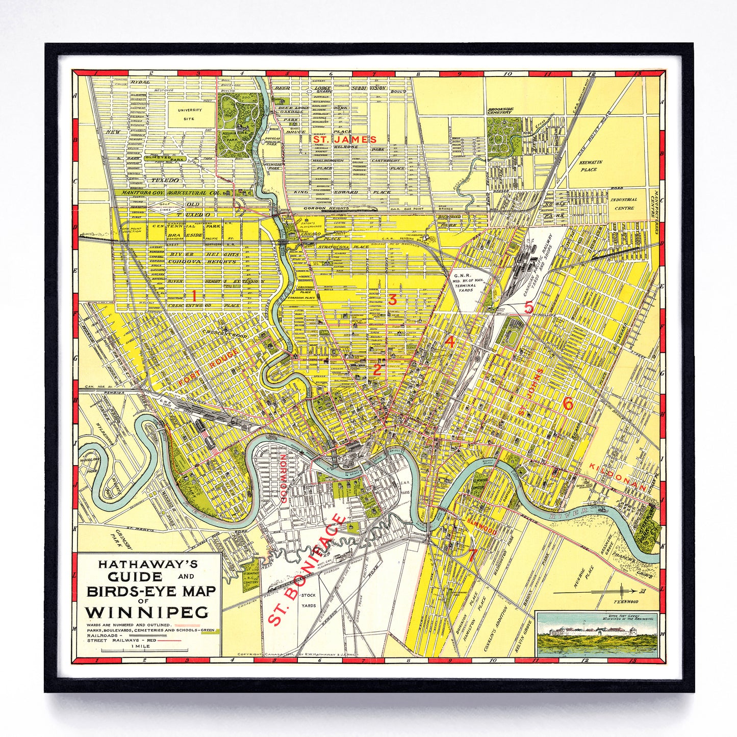
Winnipeg bloomed early in the 20th century, and when R. W. Hathaway and J. K. Wright made this in 1911 it was the third largest city in Canada and had much to show off, pictorially. Of note: the train bisecting St. Boniface on the CPR line at bottom, the treed parks and cemeteries, the tiny buildings and the accurately-drawn bridges, all small enough that you might have to zoom in to see them. Oh, and also that “west” is “up.” While this map isn’t necessarily rare (I’m pretty sure you can order it on pillows, phone cases, shower curtains, etc. online), it is an absolute gem. Also, it may share a common artist with the 1941 Winnipeg map also in the collection. Take a look?
A reproduction available at 12” or 24” square on Epson Enhanced Matte 192 gsm paper printed with Epson UltraChrome XD2 archival ink. Sold in an open edition, unframed. Based on this public domain object held by Library & Archives Canada.