Ontario Illustrated (1867-1968)
Ontario Illustrated (1867-1968)
Couldn't load pickup availability
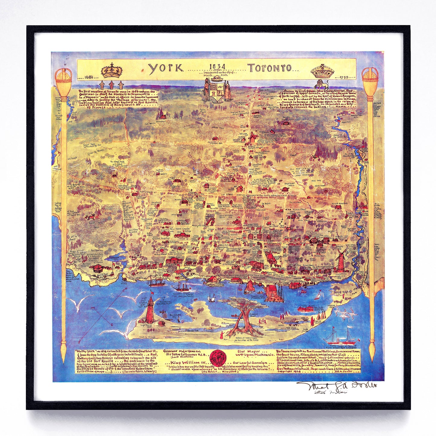
The province of Ontario is the most illustrated province in Cananda, and I've collected 26 examples of cartographers and illustrators doing it right. Of special note: Stanley Turner's incredibly professional map of Ottawa, Kingston, and surroundings, and Esther G. A. Foster's 1934-drawn amateur-but-incredible Toronto in 1834. Not seeing a city you'd like to see? Drop me a line—my collection does go deeper than this.
Included in this collection: images of Belleville, Brantford, Brockville, Cambridge, Cornwall, Guelph, Hamilton, Kingston, London, Ottawa, Peterborough, St. Catharines, Sarnia, Stratford, Sudbury, Thunder Bay, Toronto, and Whitby.
1. “Galt (Cambridge) Ontario”
print by Pathfinder Air Surveys Ltd. (1961)
2. "Guidal Landowners' Map of the Township of Guelph"
print by Alfred E. Guidal (1917)
3. "Bird's Eye View of Hamilton"
print by Herman Brosius (1876)
4. “Pictorial and Tourist Map of the City of Ottawa”
by Ottawa's Industrial & Publicity Bureau (1940)
5. “Map of Sudbury Mining District”
print by J. Walter Evans (1900)
6. “City of Hamilton”
print by the Toronto Lithographing Co. (1894)
7. “Brading's Vacation Map
of the Ottawa Valley & Eastern Ontario”
print by Stanley Turner (1946)
8. “Clearview City Directory Map (of) Sudbury”
print by Vernon-Might (1931)
9. “Bird's Eye View of Brockville”
print by Herman Brosius (1874)
10. “City of London”
print by the Toronto Lithographing Co. (1893)
11. “City of Sarnia”
print by Graphic Publishers Canada (1955)
12. “Number of Street Cars and Vehicles
in the Downtown District of Toronto”
print by the Civic Trans. Committee (1915)
13. “Clearview City Directory Map (of) Brantford”
print by Vernon-Might (1931)
14. "Bird's Eye View of London"
print by Eli Sheldon Glover (1872)
15. "Birds Eye View of the City of ... Sarnia"
print by Albert Ruger (1867)
16. "Birds-Eye View of Toronto"
print by Peter Alfred Gross (1876)
17. “Bird's Eye View of Belleville”
print by Herman Brosius (1874)
18. "Kingston Ontario Experimental Photo Map"
print by the Department of National Defence (1968)
19. “Bird's Eye View of Peterborough”
print by Herman Brosius (1875)
20. “Port Arthur (Thunder Bay)”
print by J. C. Young & R. J. Edwards (1885)
21. “City of Ottawa”
print by the Toronto Lithographing Co. (1895)
22. “Stratford: the Festival City”
print by Pathfinder Air Surveys Ltd. (1964)
23. “East Whitby Centennial Map”
print by Anonymous (1967)
24. “Bird's Eye View of the City of Ottawa”
print by Herman Brosius (1876)
25. “Street Map and Reference Guide of St. Catharines”
print by Anonymous (1950)
26. “York 1834 Now Incorporated as the City of Toronto”
print by Esther G. A. Foster (1934)
Original sources include the Archives de Montréal, the Association of Canadian Map Libraries & Archives, the Brock University Map, Data, and GIS Library, the Hastings County Historical Society, Library & Archives Canada, the Library of Congress, the McMaster University Libraries Digital Archive, Natural Resources Canada, Pathfinder Maps, the University of Milwaukee Wisconsin Map Collection, the University of Toronto Libraries Map & Data Library, Western University Library, and the York University Digital Library.
Each reproduction is available in one or two different sizes on Epson Enhanced Matte 192 gsm paper printed with Epson UltraChrome XD2 archival ink. Sold in an open edition, unframed.