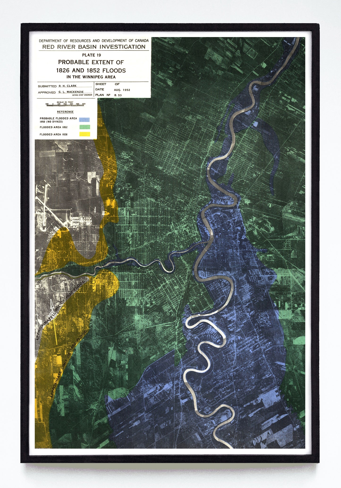
“Probable Extent of the 1826 & 1852 Floods in the Winnipeg Area” print by the Red River Basin Investigation (1952)
“Probable Extent of the 1826 & 1852 Floods in the Winnipeg Area” print by the Red River Basin Investigation (1952)
Regular price
$60.00 CAD
Regular price
Sale price
$60.00 CAD
Unit price
per
Shipping calculated at checkout.
Couldn't load pickup availability
I love maps that aren't overtly made as decoration but check all the boxes my mind asks of decoration. Like this one. It's a for-internal-use colour-coded aerial photograph where an engineer circa 1952 (R. H. Clark) plotted the "probable" extent of three historic Manitoba floods. The collision of anthropocene grids and nature's flood plains brings it to a whole other place. This is both reference material and a treat for the eyes.
A reproduction available at 12x18" or 24x36" on Epson Enhanced Matte 192 gsm paper printed with Epson UltraChrome XD2 archival ink. Sold in an open edition, unframed. Restored from this public domain digital file found in Manitoba Historical Maps.