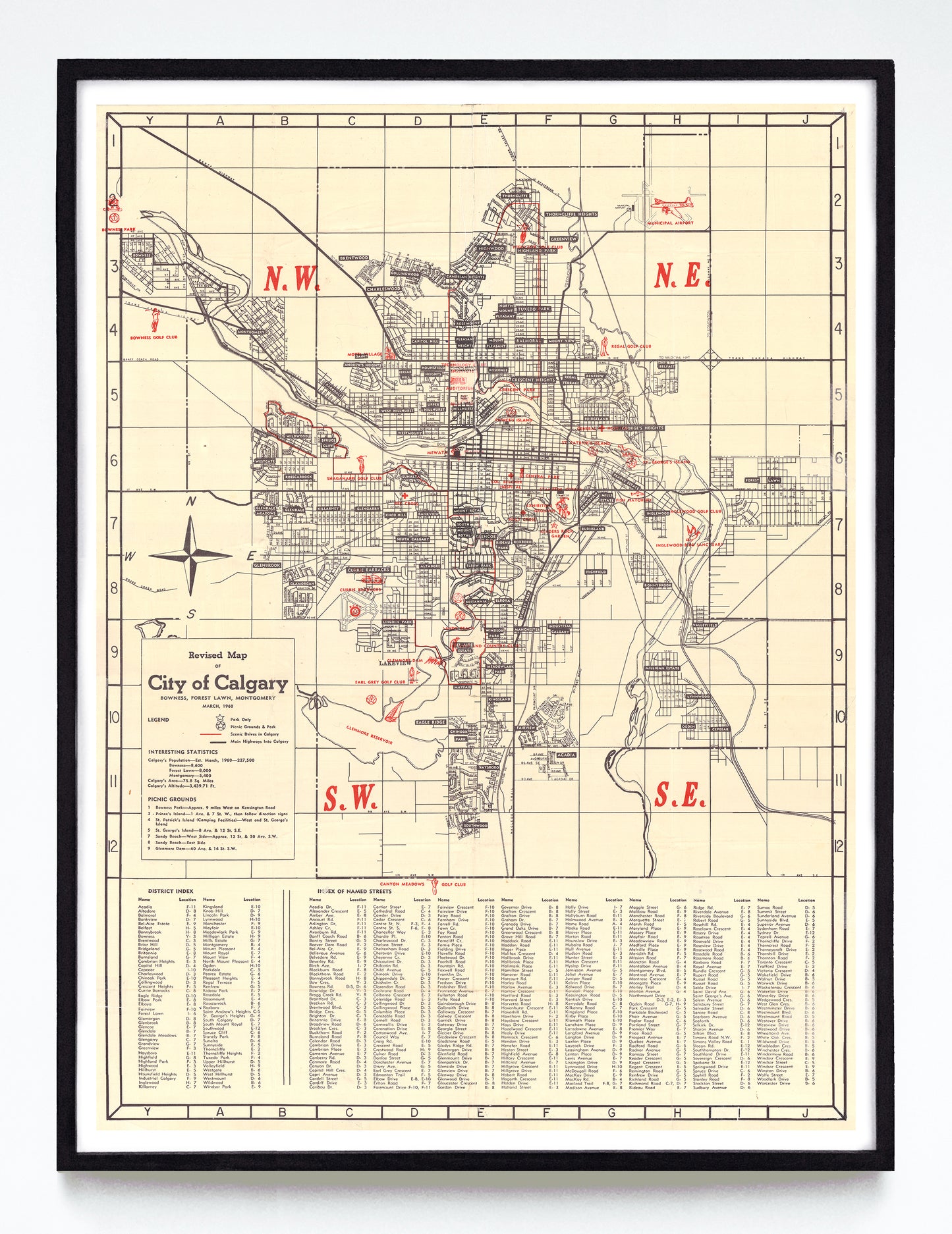
"Revised Map of (the) City of Calgary" print by Anonymous (1960)
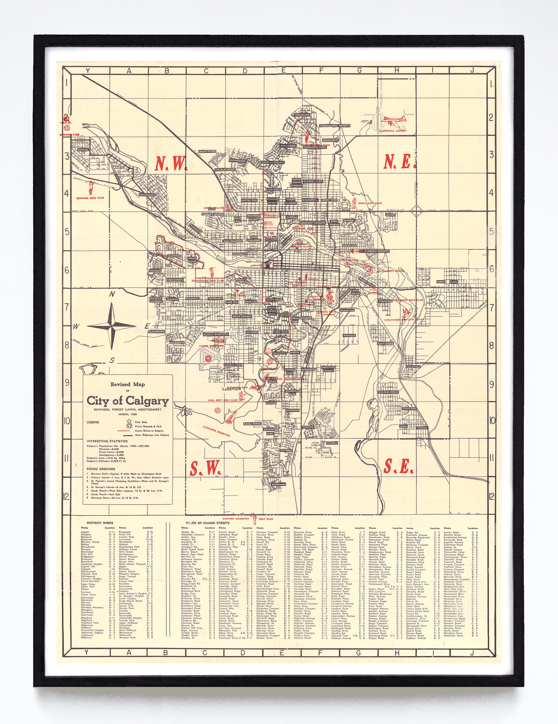
"Revised Map of (the) City of Calgary" print by Anonymous (1960)
Couldn't load pickup availability
I am completely charmed by the dozen or so red icons overlaying this well-labelled map of Calgary at mid-century. We see a little red plane at the "Municipal Airport", a canoe and cabin at Bowness Park, an armoured tank at the Currie Barracks, the Glenmore Dam, a sailboat in the Glenmore Reservoir, a bucking bronco you-know-where, a dinosaur at St. George's Island, a duck at the Inglewood Bird Sanctuary, and no less than half a dozen golfers throughout. Also of note: a fish, some hospitals, and the still-fresh Southern Alberta Jubilee Auditorium.
A reproduction available at 12x16" or 18x24" on Epson Enhanced Matte 192 gsm paper printed with Epson UltraChrome XD2 archival ink. Sold in an open edition, unframed. Based on this original public domain image held by the Historical Maps Collection at the University of Calgary Libraries & Cultural Resources Digital Collection.