“Street Map and Reference Guide of St. Catharines, Canada & Vicinity” print by Anonymous (1950)
“Street Map and Reference Guide of St. Catharines, Canada & Vicinity” print by Anonymous (1950)
Regular price
$60.00 CAD
Regular price
Sale price
$60.00 CAD
Unit price
per
Shipping calculated at checkout.
Couldn't load pickup availability
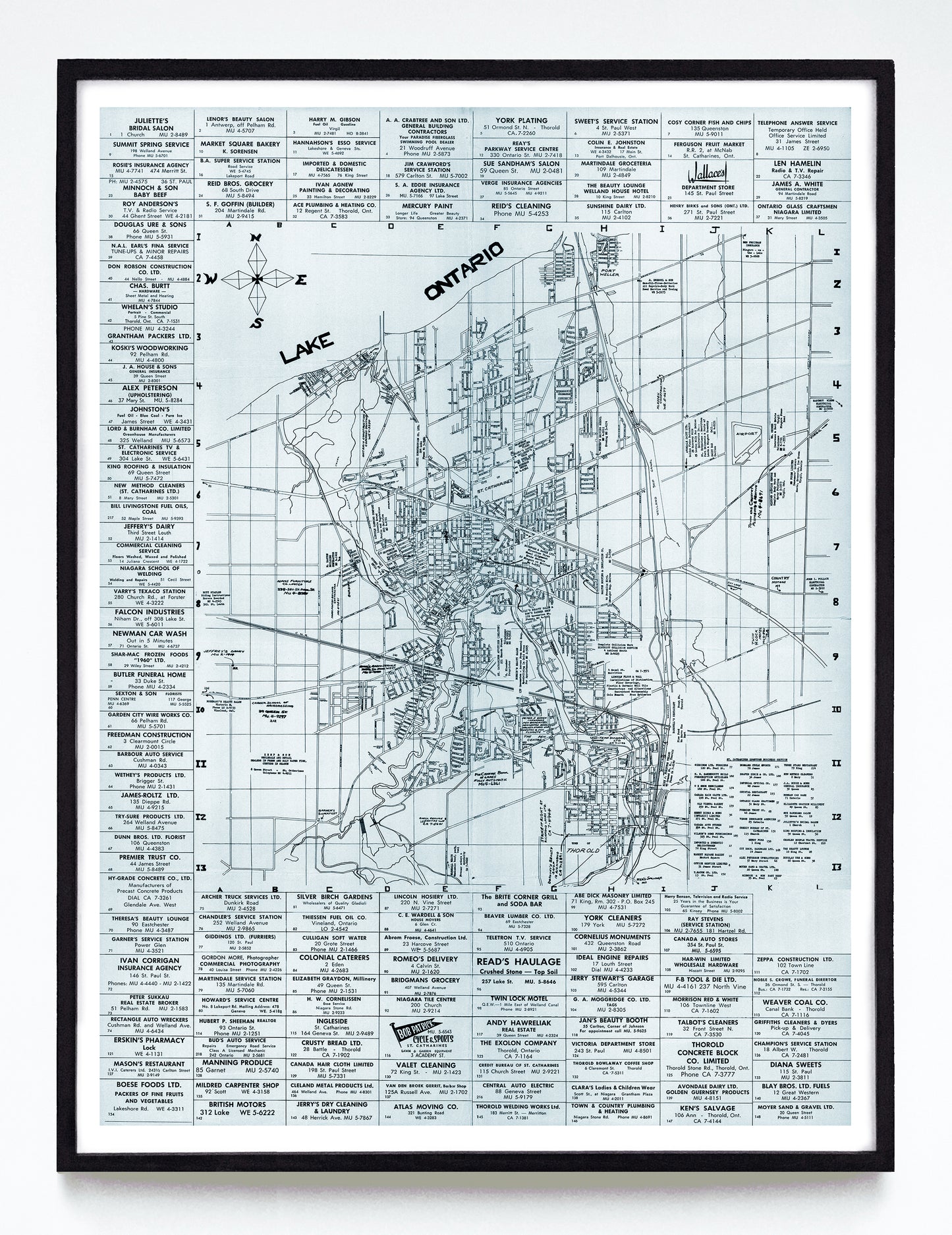
I have a thing for large amounts of gridded text, and this very did-it-themselves 1950 map of St. Catharines has it in bulk. Seemingly, only two businesses (Wallace’s at top right and Bob Patrick Cycle & Sports at bottom) got the memo that logos could be worked into the layout, and I appreciate the pale blue paper, unique compass rose and how the “Lake Ontario” label has been penned with angular imperfection.
A reproduction available at 12x16" or 18x24" on Epson Enhanced Matte 192 gsm paper printed with Epson UltraChrome XD2 archival ink. Sold in an open edition, unframed. Based on this original public domain image held by the Brock University Map, Data, and GIS Library.