Atlantic Canada Illustrated (1878-1979)
Atlantic Canada Illustrated (1878-1979)
Couldn't load pickup availability
Nine maps—however detailed—cannot describe all of Atlantic Canada, but here are seven that tried to do so between 1878 and 1979. On that first year the famed Prussian-American artist Albert Ruger came all the way to Charlottetown to put it on paper, and 101 years later the Fredericton Chamber of Commerce hired ace Vancouver illustrator Bob Banks to do the same to Fredericton. This collection offers you reproductions of both of those prints, along with a few others works showing Fredericton, Halifax, Saint John, Truro, Sydney, and St. John's.
Original sources include Canadian GIS & Geospacial Resources, the estate of Bob Banks, the Halifax Municipal Archives, Library & Archives Canada, the Library of Congress, the Memorial University of Newfoundland Queen Elizabeth II Map Room, the Norman B. Levanthal Map & Education Center, and the Nova Scotia Archives.
In this collection:
1. “Fredericton: the City of Stately Elms”
print by Bob Banks (1979)
2. “St. John's Coronation Souvenir Map”
print by W. P. Ryan et. al. (1937)
3. "City of Fredericton, N.B."
print by Alexander M. Hubley (1882)
4. “Map of Truro, N. S.”
print by C. F. McAlpine (1911)
5. "Halifax Nova Scotia"
print by Arthur W. Wallace (1935)
6. "Panoramic View of Charlottetown PEI"
print by Albert Ruger (1878)
7. “Panoramic View of the City of Halifax, NS”
print by Albert Ruger (1879)
8. “Illustrated Plan of Saint John NB”
print by Arthur W. Wallace (1934)
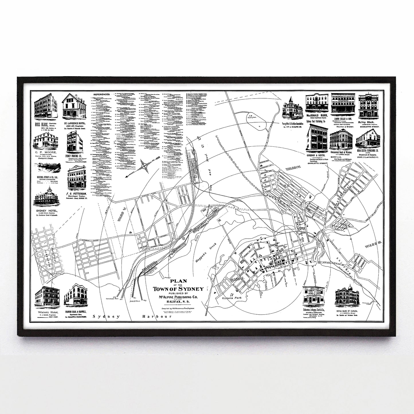
9. “Plan of the Town of Sydney”
print by McAlpine Publishing Co. Ltd (1902)
Each reproduction is available in one or two different sizes on Epson Enhanced Matte 192 gsm paper printed with Epson UltraChrome XD2 archival ink. Sold in an open edition, unframed.