“Visitors Map of Vancouver” by the Vancouver Tourist Association (1953)
“Visitors Map of Vancouver” by the Vancouver Tourist Association (1953)
Couldn't load pickup availability
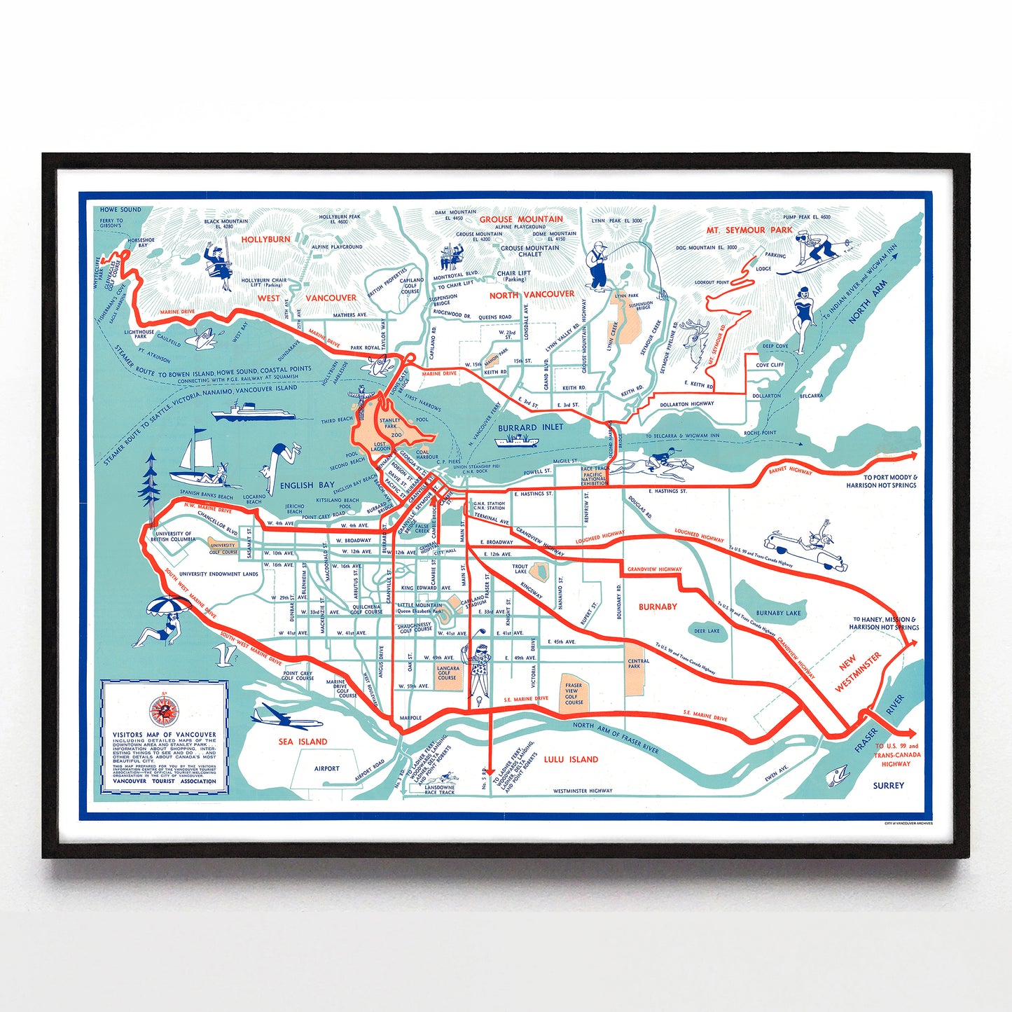
Postwar Vancouver has been thoroughly depicted by illustrators, and this charming and efficiently drawn two-colour pamphlet map published by the Vancouver Tourist Association uses (uncredited) drawings to exclaim “there are pleasant times to be had here!” In it, at least three small figures wave at the viewer, one from the still-new Hollyburn chair lift (in operation from 1951-1965), one from the Grouse Mountain chair lift (also installed in 1951), and one from a convertible coupe cruising through Burnaby on the Lougheed Highway.
Elsewhere, a Mount Seymour skier skis an inch from a bather dipping her toe in the North Arm, boaters and tourists proliferate, and wild fish with casual, loose lines splash off the coast of North Vancouver. The map itself is mid-century design at its best with thick red arrows and blue roads fluidly tying everything together in a coherent urban package. Even its mysteries are appealing—why is it the same woman on two different gondolas in the same pose at the same time? What is the seagull at bottom left puzzling over?
On the inverse of the map are local traffic rules, shopping information (including mention of free “Shopping Counsellors”), photos of attractions, blow-up maps of the downtown and Stanley Park, and promises of generous hospitality. This same map would be used until at least the early 1960s, albeit in diminished form—the 1954 version was printed in only one colour (navy blue), and by 1960 its illustrations were entirely erased.
A reproduction available at 16x12" or 24x18" on Epson Enhanced Matte 192 gsm paper printed with Epson UltraChrome XD2 archival ink. Sold in an open edition, unframed. Based on this original public domain image held the City of Vancouver Archives.