Western Canada Illustrated (1878-1976)
Western Canada Illustrated (1878-1976)
Couldn't load pickup availability
While most of Western Canada was too "young" to get in on the bird's eye panoramic city view boom of the 1870s, various artists and cartographers captured the region in their own ways. Need an example? Take a look at Hathaway and Wright's map of Winnipeg in 1911, where they've put north to the right and east down.
Included in this collection: images of Banff, Brandon, Calgary, Dawson, Edmonton, Jasper, Lethbridge, Regina, Saskatoon, Vancouver, Victoria, and Winnipeg.
1. “All Roads Lead to the Regina Exhibition” print (1919)
2. “City of Calgary Interim Zoning Guide” print
by C. G. A. May (1952)
3. “Jasper National Park” print (1935)
4. “Occupancy Map Downtown Regina” print
by C.B.O. Drafting & Computing (1976)
5. "Edmonton" print
by the Canadian Dept. of the Interior (1915)
6. “Hathaway's Guide & Birds-Eye Map of Winnipeg” print
by R. W. Hathaway & J. K. Wright (1911)
7. “Probable Extent of the 1826 & 1852
Floods in the Winnipeg Area” print
by the Red River Basin Investigation (1952)
8. “Bird's Eye View of Victoria” print
by Eli Sheldon Glover (1878)
9. “Map of the City of Calgary Alberta
Compiled from Registered Plans” print
by the Crown Lithograph Co. (1908)
10. "Birdseye View of Dawson, Yukon Ter." print
by H. Epting (1903)
11. “Visitors Map of Vancouver” print
by the Vancouver Tourist Association (1953)
12. "Revised Map of (the) City of Calgary" print (1960)
13. “City of Calgary 17 October 1924” print
by Jack A. Cuvelier of Air Photo Services (1974)
14. “Lethbridge” print
by the Alberta Railway & Coal Co. (1890)
15. “Panoramic View of the City of Vancouver” print
by the Vancouver Daily World (1898)
16. "Motor Drives at Banff" print
by the Canadian Gov. Travel Bureau (1954)
17. “Official Plan City of Saskatoon” print
by the Saskatoon Board of Trade (1926)
18. "Winnipeg, Manitoba" print
by T. M. Fowler (1881)
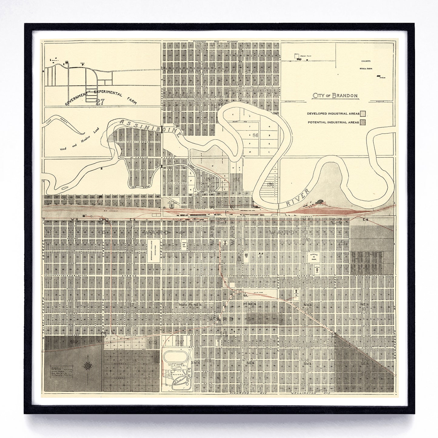
19. “City of Brandon” print
by the Manitoba Dept. of Industry & Commerce (1950)
Original sources include the 1915 Atlas of Canada, the Association of Canadian Map Libraries & Archives, Canadian GIS, the City of Regina Archives, the City of Vancouver Archives, the David Rumsey Map Collection, Library & Archives Canada, the Library of Congress, the Manitoba Historical Maps Flickr, the University of Alberta’s Peel Library, the University of Calgary Libraries Historical Maps Collection, the University of Lethbridge Digital Library, and Wikipedia.
Each reproduction is available in two different sizes on Epson Enhanced Matte 192 gsm paper printed with Epson UltraChrome XD2 archival ink. Sold in an open edition, unframed.