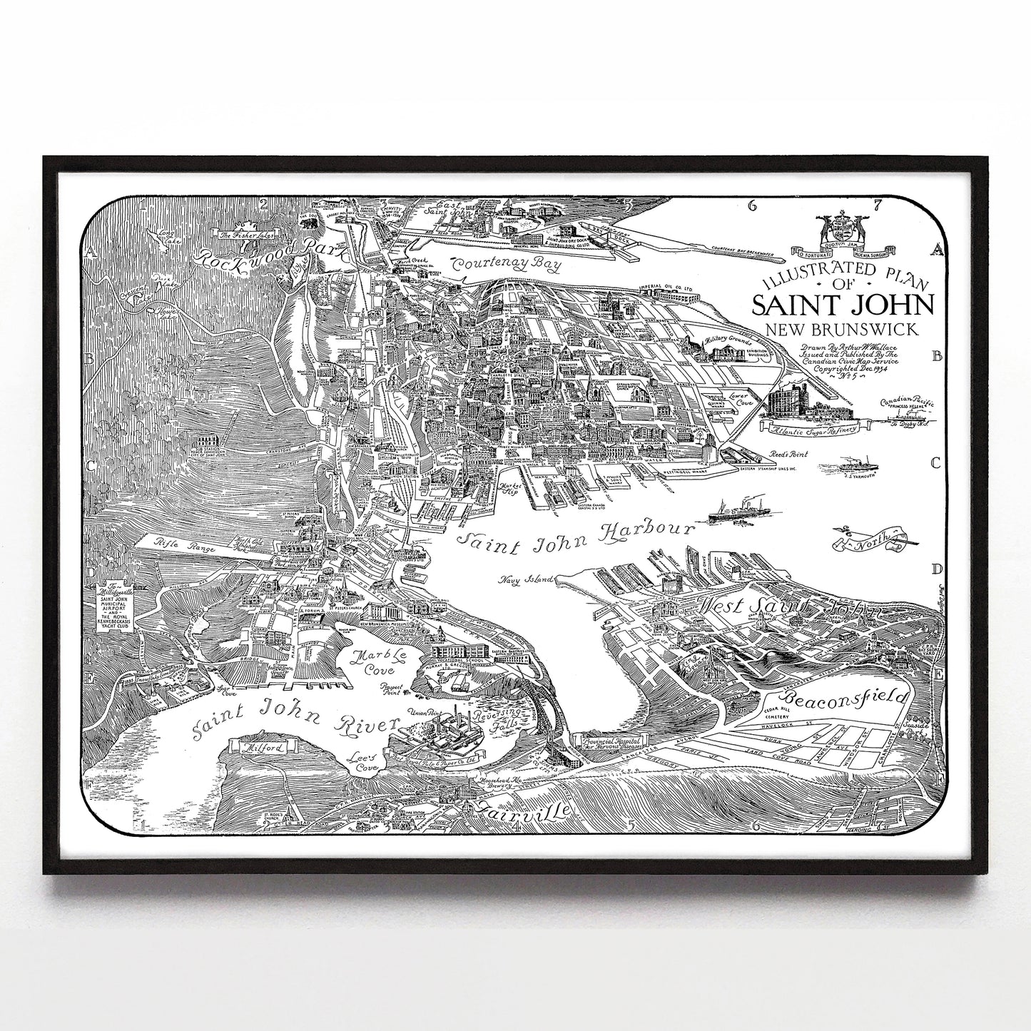
“Illustrated Plan of Saint John New Brunswick” print by Arthur W. Wallace (1934)
“Illustrated Plan of Saint John New Brunswick” print by Arthur W. Wallace (1934)
Couldn't load pickup availability
Arthur W. Wallace has been one of my great "discoveries" of 2024; I started the year thinking I knew all the major Canadian pictorial mapmakers of the 20th century, but then he showed up in my research. He's drawn everything from Halifax and Sydney, Nova Scotia, to an absolutely stunning 1937 map of Windsor, Ontario, all with a maximalist approach to linework and a fantastic jumbled perspective when it came to illustrating buildings.
If you know of a high-resolution colour version of this map, please let me know - I'd love to see it. And if you're in the Hamilton-Burlington area, you can visit his old house in Waterdown.
A reproduction available at 16x12" or 24x18" on Epson Enhanced Matte 192 gsm paper printed with Epson UltraChrome XD2 archival ink. Sold in an open edition, unframed. Restored from this pubic domain image provided by Canadian GIS.