"Kingston Ontario Experimental Photo Map" print by the Department of National Defence (1968)
"Kingston Ontario Experimental Photo Map" print by the Department of National Defence (1968)
Regular price
$60.00 CAD
Regular price
Sale price
$60.00 CAD
Unit price
per
Couldn't load pickup availability
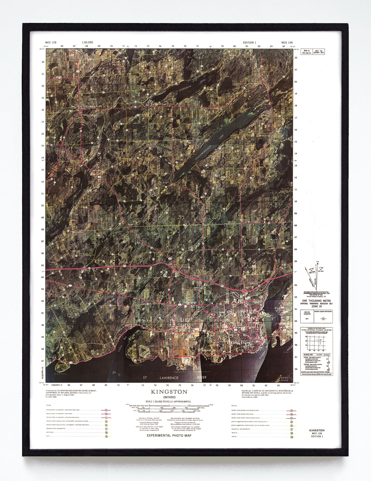
In the late 1960s Canada's Department of National Defence experimented with using high-altitude colour aerial photomosaics to form a map’s base layer, then graphically highlighting and labelling roads, trails and tracks after the fact. Here we have a 1968 example of such a map from the York University map library showing Kingston, Ontario, and environs from Eel Bay to the St. Lawrence River.
A reproduction available at 12x16" or 18x24" on Epson Enhanced Matte 192 gsm paper printed with Epson UltraChrome XD2 archival ink. Sold in an open edition, unframed. Based on this original public domain image held by the York University Digital Library.