“The City of Quebec with Historical Notes” print by S. H. Maw (1932)
“The City of Quebec with Historical Notes” print by S. H. Maw (1932)
Couldn't load pickup availability
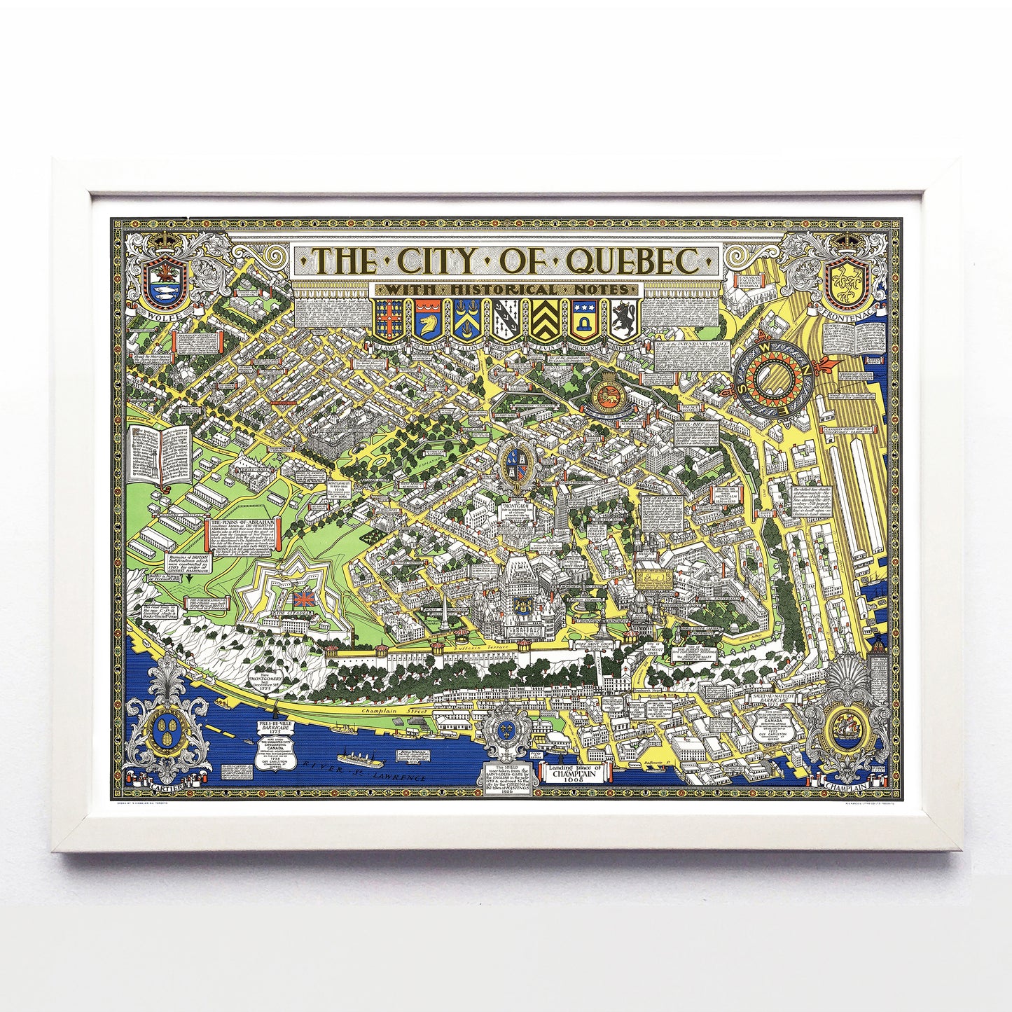
There are not more colourful, explanatory, or detailed pictorial maps of a Canadian cities than S. H. Maw’s twin Québec and Montréal maps, and together they are an incredibly pair. This one took Maw six years to draw while he worked days at the noted Montréal architecture firm Ross & Macdonald, and later as the head of the T. Eaton Co.’s Architectural Department. While it was obviously a labour of love it was definitely a commercial object: for decades it was available as a 35x27” tourist map at various Québec City shops.
In the extreme top left you can find modern-day Avenue de Salaberry. At bottom right is the Lower Town and a note from the artist that reads “ This map commenced in 1926 (and) completed in 1932. Drawn by S. H. Maw. Dimensions and proportions must not be taken seriously. It being the intention of the author only to amuse and instruct.” Its deep greens, yellows, blues and reds were applied via lithograph by the Alexander Lithography, a company that still exists at 82 Berkeley Street in Toronto.
The Biographical Dictionary of Architects in Canada describes Samuel Herbert Maw as “a brilliant delineator, etcher, architect, cartographer and designer,” and before his 1952 death he'd lived everywhere from England to Ontario. He was clearly influenced by the work of British artist MacDonald Gill (best known for his 1914 Wonderground Map of London), but Maw’s creative package included less whimsy and copious historical asides.
A reproduction available at 16x12" or 24x18" on Epson Enhanced Matte 192 gsm paper printed with Epson UltraChrome XD2 archival ink. Sold in an open edition, unframed. Based on this original public domain image held by the Bibliothèque et Archives Nationales du Québec.