-
Paper Cities
I'm not sure what came first—my interest in illustrating cities that I've been to, or my interest in how other illustrators have drawn cities that I've been to. Either way, I fell in love with the 19th century "urban panoramic bird's eye view" genre in the early 2010s, and since then I've been charmed any kind of image that attempts to capture our impossibly complex urban landscapes. Find below a few of my favourite illustrated maps that exist in the public domain, which I've retouched and am making available to you via the studio's in-house printer.
-
-
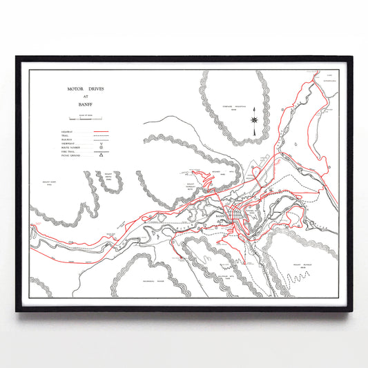
"Motor Drives at Banff" print by the Canadian Government Travel Bureau (1954)
Regular price From $60.00 CADRegular priceUnit price per -
“Bird's Eye View of Belleville Ontario, Canada” print by Herman Brosius (1874)
Regular price From $60.00 CADRegular priceUnit price per -
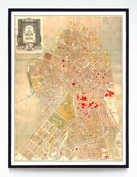
“Map of the Central Business District of Boston” print by George W. Stadly & Co. (1896)
Regular price From $60.00 CADRegular priceUnit price per -
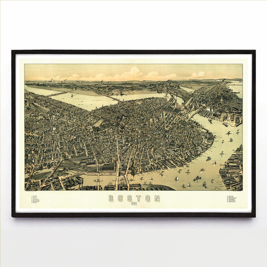
"Boston" print by Albert E. Downs (1899)
Regular price From $60.00 CADRegular priceUnit price per -
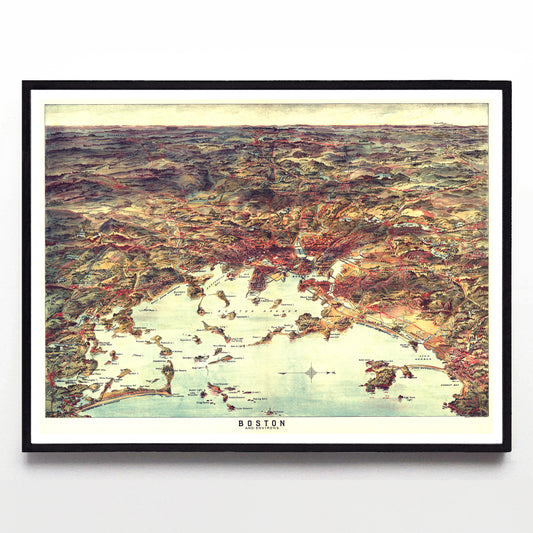
“Boston & Environs” print by George E. Walker & Associates (1905)
Regular price From $60.00 CADRegular priceUnit price per -
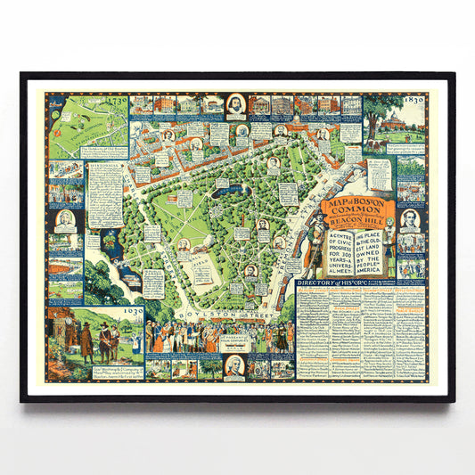
“Map of Boston Common with Surrounding Streets & Adjacent Parts of Beacon Hill” print by Griswold Tyng (1934)
Regular price From $60.00 CADRegular priceUnit price per -
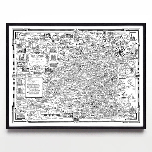
“Boston (Massachusetts) & Vicinity” print by Ernest Dudley Chase (1938)
Regular price From $60.00 CADRegular priceUnit price per -
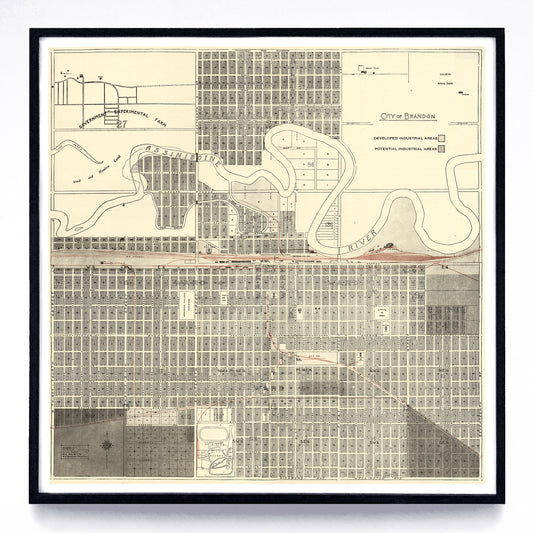
“City of Brandon” print by the Manitoba Dept. Of Industry & Commerce (1950)
Regular price From $60.00 CADRegular priceUnit price per -
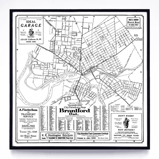
“Clearview City Directory Map (of) Brantford, Ont.” print by Vernon-Might (1931)
Regular price From $60.00 CADRegular priceUnit price per -
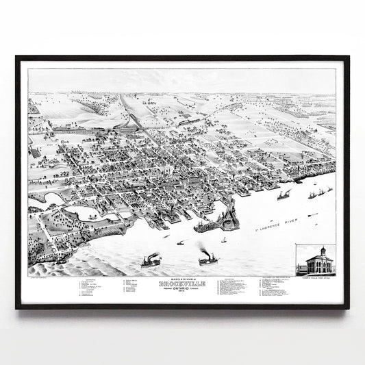
“Bird's Eye View of Brockville Ontario” print by Herman Brosius (1874)
Regular price From $60.00 CADRegular priceUnit price per -
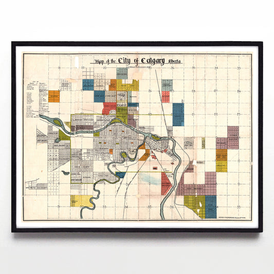
“Map of the City of Calgary Alberta Compiled from Registered Plans” by the Crown Lithograph Co. (1908)
Regular price From $60.00 CADRegular priceUnit price per -
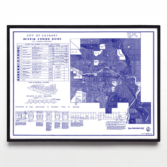
“City of Calgary Interim Zoning Guide” print by C. G. A. May (1952)
Regular price From $60.00 CADRegular priceUnit price per -
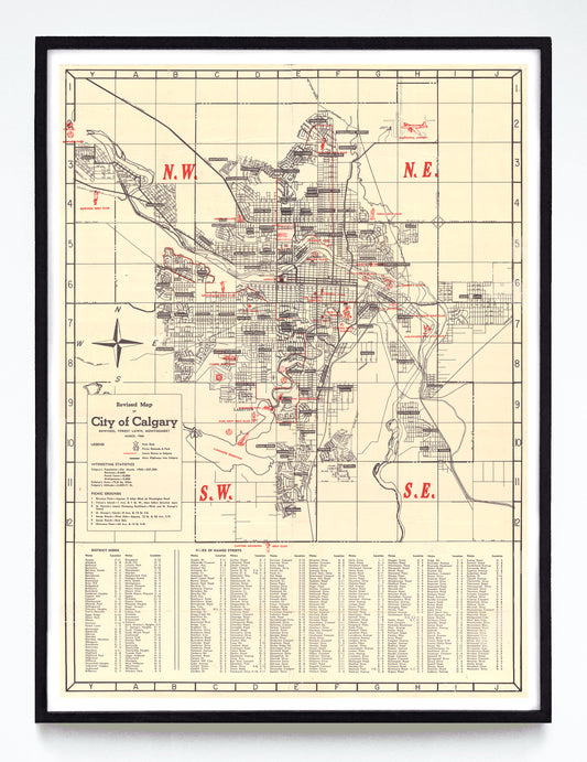
"Revised Map of (the) City of Calgary" print by Anonymous (1960)
Regular price From $60.00 CADRegular priceUnit price per -
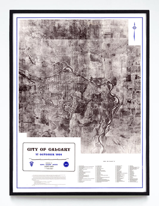
“City of Calgary 17 October 1924” print by Jack A. Cuvelier of Air Photo Services (1974)
Regular price From $60.00 CADRegular priceUnit price per -
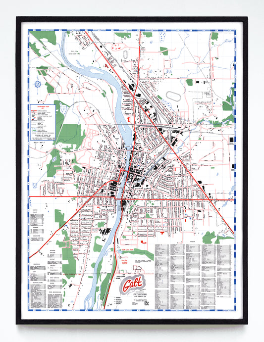
“Galt (Cambridge) Ontario” print by Pathfinder Air Surveys Ltd. (1961)
Regular price From $60.00 CADRegular priceUnit price per -
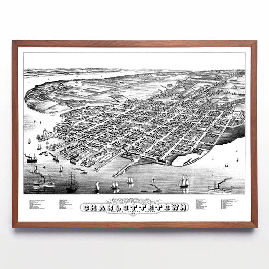
"Panoramic View of Charlottetown Prince Edward Island" print by Albert Ruger (1878)
Regular price From $60.00 CADRegular priceUnit price per -
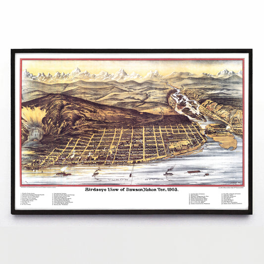
"Birdseye View of Dawson, Yukon Ter." print by H. Epting (1903)
Regular price From $60.00 CADRegular priceUnit price per -
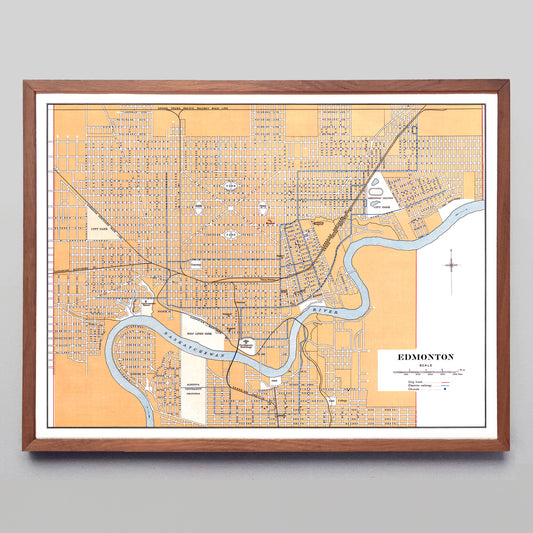
"Edmonton" print by the Canadian Department of the Interior (1915)
Regular price From $60.00 CADRegular priceUnit price per -
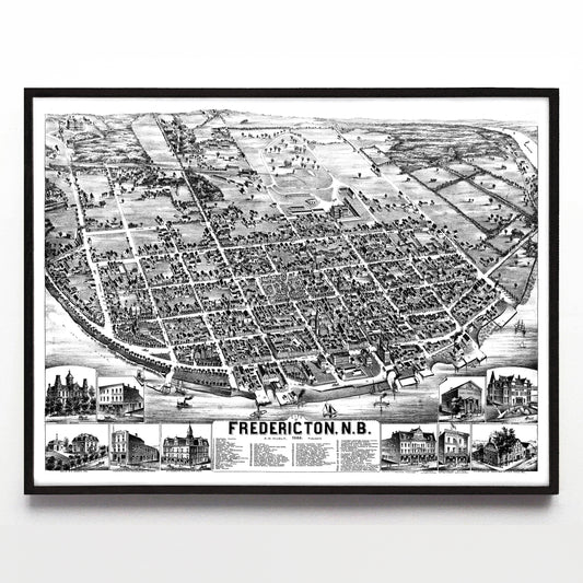
"City of Fredericton, N.B." print by Alexander M. Hubley (1882)
Regular price From $60.00 CADRegular priceUnit price per -
“Fredericton: the City of Stately Elms” by Bob Banks (1979)
Regular price From $60.00 CADRegular priceUnit price per -
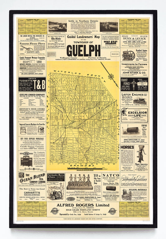
"Guidal Landowners' Map of the Township of Guelph" print by Alfred E. Guidal (1917)
Regular price From $60.00 CADRegular priceUnit price per -
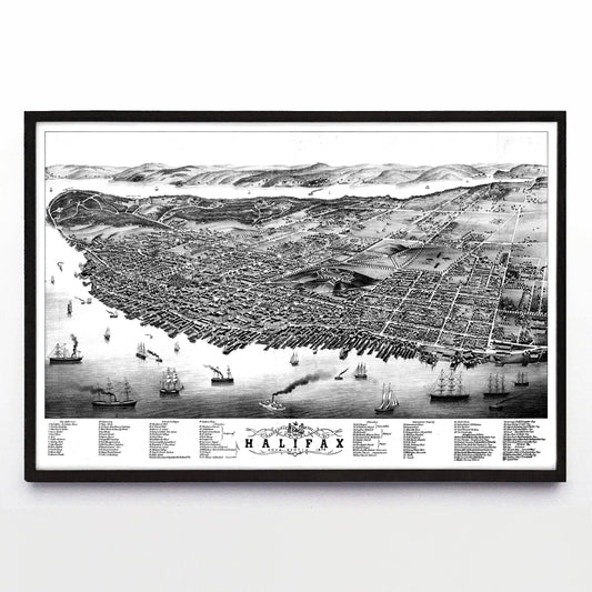
“Panoramic View of the City of Halifax, Nova Scotia” by Albert Ruger (1879)
Regular price From $60.00 CADRegular priceUnit price per -
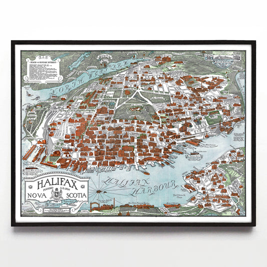
"Halifax Nova Scotia" print by Arthur W. Wallace (1935)
Regular price From $60.00 CADRegular priceUnit price per -
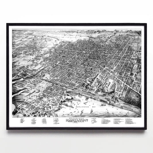
"Bird's Eye View of Hamilton, Ontario" print by Herman Brosius (1876)
Regular price From $60.00 CADRegular priceUnit price per -
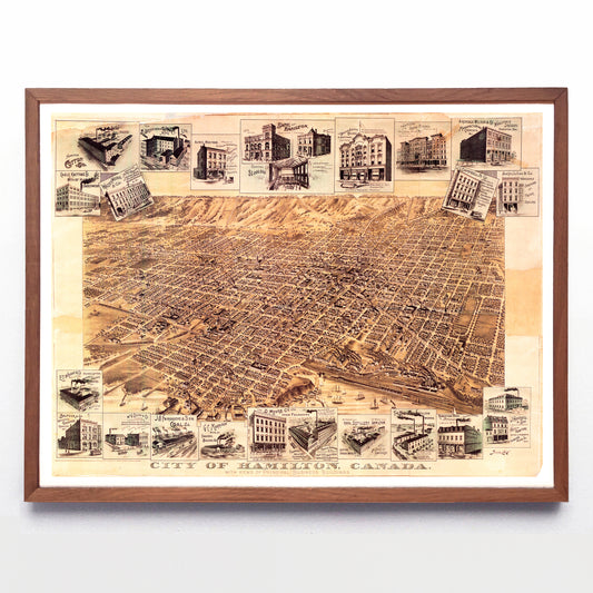
“City of Hamilton, Ontario” print by the Toronto Lithographing Co. (1894)
Regular price From $60.00 CADRegular priceUnit price per