-
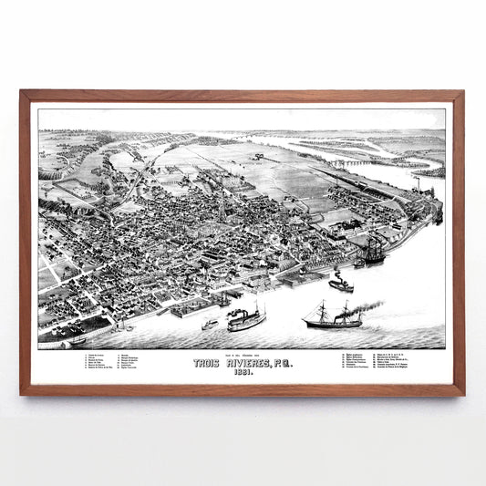
“Vue à Vol d'Oiseau des Trois Rivières, P. Q.” print by Henry Wellge (1881)
Regular price From $60.00 CADRegular priceUnit price per -
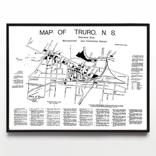
“Map of Truro, N. S.” print by C. F. McAlpine (1911)
Regular price From $60.00 CADRegular priceUnit price per -
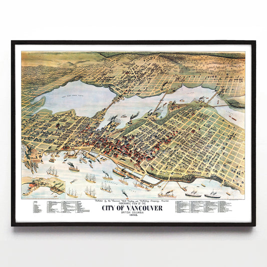
“Panoramic View of the City of Vancouver” print by the Vancouver Daily World (1898)
Regular price From $60.00 CADRegular priceUnit price per -
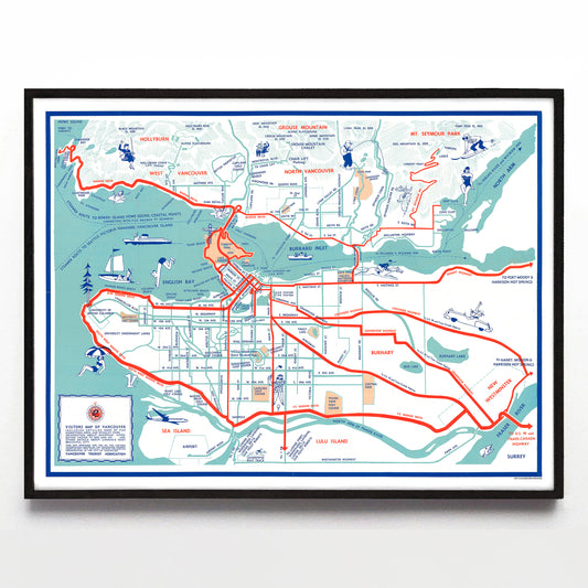
“Visitors Map of Vancouver” by the Vancouver Tourist Association (1953)
Regular price From $60.00 CADRegular priceUnit price per -
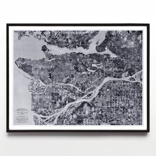
“Metro Vancouver” print by Webb & Knapp Ltd. (1957)
Regular price From $60.00 CADRegular priceUnit price per -
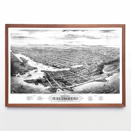
“Bird's Eye View of Victoria, Vancouver Island, B. C.” print by Eli Sheldon Glover (1878)
Regular price From $60.00 CADRegular priceUnit price per -
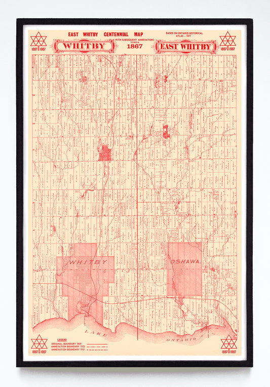
“East Whitby Centennial Map” print by Anonymous (1967)
Regular price From $60.00 CADRegular priceUnit price per -
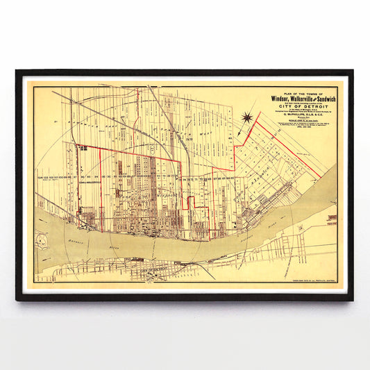
“Plan of the Towns of Windsor, Walkerville and Sandwich” print by G. McPhillips (1890)
Regular price From $60.00 CADRegular priceUnit price per -
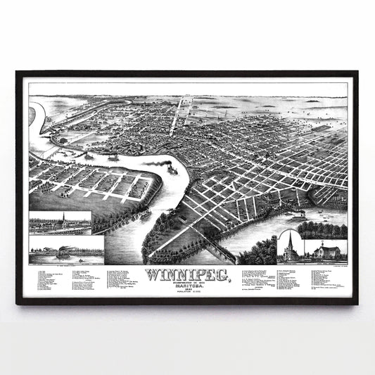
"Winnipeg, Manitoba" print by T. M. Fowler (1881)
Regular price From $60.00 CADRegular priceUnit price per -
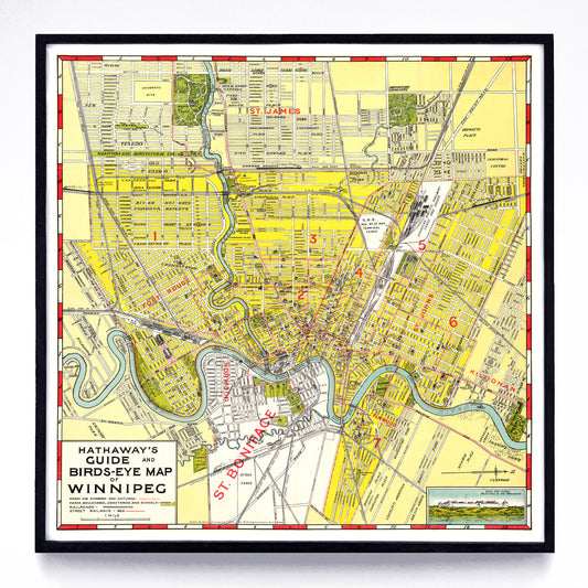
“Hathaway's Guide & Birds-Eye Map of Winnipeg” print by R. W. Hathaway & J. K. Wright (1911)
Regular price From $60.00 CADRegular priceUnit price per -
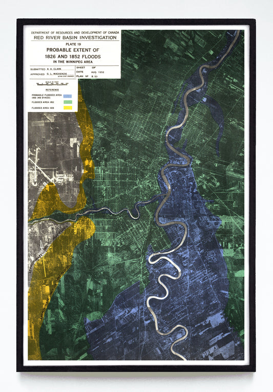
“Probable Extent of the 1826 & 1852 Floods in the Winnipeg Area” print by the Red River Basin Investigation (1952)
Regular price From $60.00 CADRegular priceUnit price per -
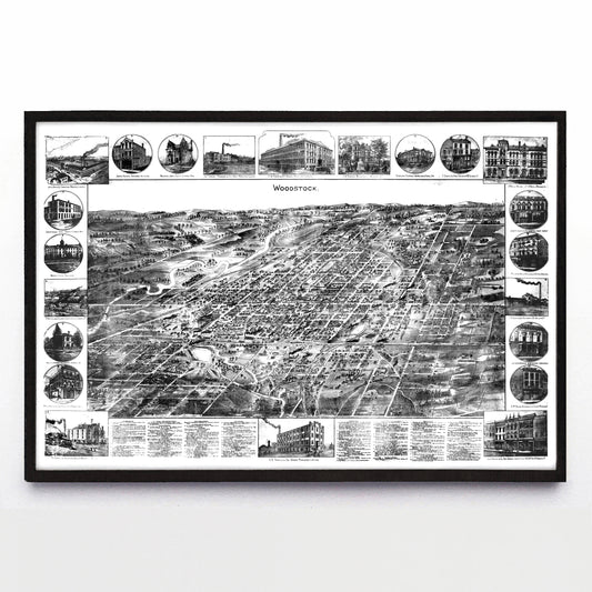
“Woodstock” print by William Nathaniel Wesbroom (1885)
Regular price From $60.00 CADRegular priceUnit price per